Sunday, May 29, 2016

LIRR Long Island City

LIRR Long Island City
In May, 2011, I went out to a restaurant in Long Island City, Queens. After I left the restaurant, I drove down to the LIRR station. Long Island City Station is the head of LIRR's diesel passenger operations. In the olden days (before 1911), passengers would travel west across LI to this station. then, they would embark on a ferry to 34th Street. In 1911, tunnels to a new station on 34th opened; trains from Long Island could go directly into Manhattan. This made the ferry and LIC Station relatively obsolete. 
 Take a look at this ticket booth off to the right. These things were on the platforms at Jamaica until it was renovated in the 2000s. 

 One of the passenger platforms here. These high boarding platforms were installed around 2000.


 Looking out into the yard. These are service platforms for the crew to access the trains.

One of the large spring loaded bumpers.

Monday, April 25, 2016

Jayne's Hill (Huntington, NY)

Jayne's Hill
On April 24, 2016, I drove up to the highest point on Long Island, NY. It is called Jayne's Hill and it is part of West Hills County Park, in the Town of Huntington. The summit is 401 feet above sea level. The hill was once known as High Hill, but is now Jayne's Hill, named after local settlers. 


Here is an information sign and map at the park entrance. Yes, The Suffolk County Parks Dept. spelled "Jayne's" incorrectly. I am pretty certain that my spelling is correct.

Looking down Reservoir Road 

Trail towards summit. 

 
Boulder marker at the summit. Walt Whitman, a poet local to Huntington, spent much of his time on this hill. The plaque has an excerpt from one of his poems. However, there is no geographic marker indicating that this is the summit. 

Beside the boulder, I found this marker. It is unclear what it reads or how old it is.  

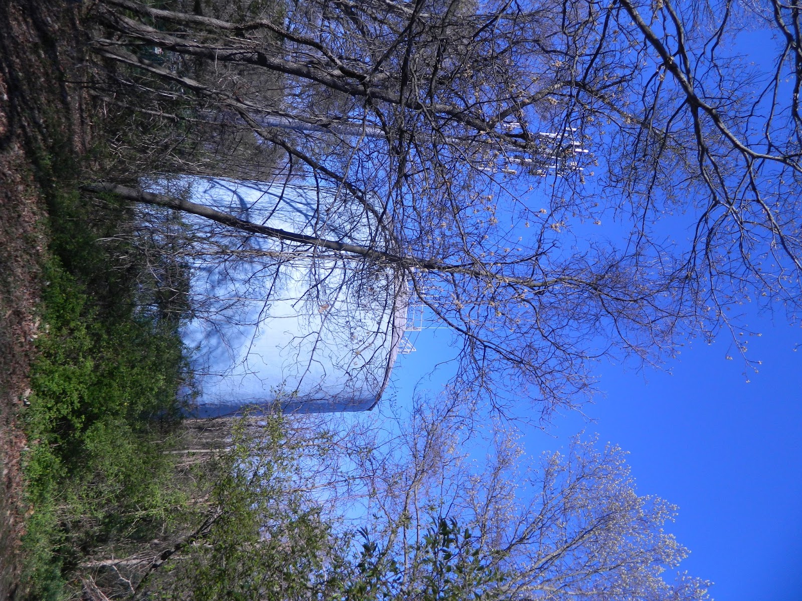
In the 1990s, the South Huntington Water District erected this water tower near the summit.  

Benches in front of the boulder.

 Looking down the hill.

While walking down the hill, away from the summit, I spotted some amenities that are abandoned. 

Swing structure with the swings removed.

Abandoned restroom building.

When it was abandoned, the kids thoroughly smashed everything up. 


Looking back towards Reservoir Road. 

Reservoir Road from the top end. 

 Photo taken while exiting the park on Reservoir Road.


DIRECTIONS:
Take Exit 40 from the Northern State Parkway or Exit 49N from the Long Island Expressway. Then head north on NYS Route 110. Continue past the Northern State Parkway overpass. Turn left on Old Walt Whitman Road. Then, turn left on West Hills Road. At the stop sign, turn left onto Reservoir Road. Continue to the very end of Reservoir Road. 


Saturday, April 2, 2016

Mill Neck LIRR Station

Mill Neck Station (Long Island Rail Road)
Mill Neck, New York is a beautiful little community in the northern part of the town of Oyster Bay. The site I visited was the former Long Island Rail Road station. Today, it is no longer operational for passengers. This station is in single track territory on the Oyster Bay Branch. Oyster Bay station is to the east and Locust Valley is to the west. 

 LIRR trains ceased operation to this station in 1998. Today's passenger cars have doors that are high off the ground, which required the construction of a higher platform. At Mill Neck, it was uneconomical because of low passenger traffic. Thus, the LIRR closed the station to passengers.


The concrete platform still sits unused, under a blanket of snow on this particular day. However, the track is fully operational; trains to and from Jamaica bypass the closed station. Also, take note of the police car in the parking lot.

(Looking east) The station building is currently used as a local police precinct and the local US Post Office.  

In this video, a westbound train runs past Mill Neck with a blast of the horn to yours truly.


DIRECTIONS:
Take Northern State Parkway Exit 35N or Long Island Expressway Exit 41N. Head north on Route 106/107. Cross under the Jericho Turnpike overpass and take the right fork onto Route 106 northbound. Pass through the Route 25A intersection. Then, turn left onto Lexington Avenue. At the end of Lexington, turn left onto West Main Street. When you reach the intersection with Mill Hill Road, take it. Then, turn right onto Beaver Brook Road. head straight onto Frost Mill Road. Cross under the LIRR tracks and turn right into the train station.

Monday, March 14, 2016

Highbridge Park

Highbridge Park
On July 3, 2015, (yes I have the exact date) I took a trip to Highbridge Park in Manhattan. The centerpiece of the park is the 1800s era aqueduct that spans the Harlem River and crosses into the Bronx. It had been open as a park in the 20th Century, but the bridge closed in the 70s during the NYC financial chaos. Quite recently, the parks department has done extensive and beautiful work to the historical bridge; it opened shortly before I visited. It provides for some fascinating views of the Bronx and Manhattan...


 Balcony above the bridge.

Long staircase down to the bridge. 

 Water tower
View of the Major Deegan Expressway from the staircase. 

Staircase landing (yes that was quite a descent)

Manhattan side of bridge. 

View of Manhattan side. 

Harlem River Drive and Alexander Hamilton Bridge in the background. 

Newly constructed bike ramp.


Views of Harlem River Dr. looking south. Before the bridge closed, vandals used to drop things over the rail onto passing cars below. 

Out on the main span looking north on the Harlem River 


Metro North multiple unit train passing below on MNR Mainline.

Bronx side. 

George Washington Bridge tower. 


 Metro North EMD locomotive.

 MNR shops

MNR switching.

Bombardier push-pull coaches.


Cross Bronx Expressway ramps.

(again) Harlem River Drive

Some type of marker. Possibly for distance? Not sure what for. Found directly adjacent to bridge on Manhattan side.